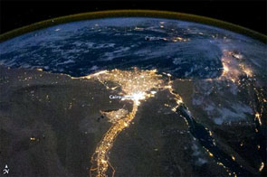
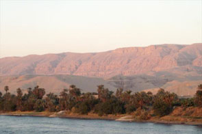
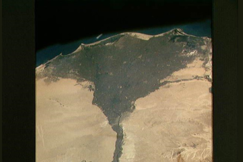
Topography is the study of the surface of the Earth and how it relates to manmade features such as cities and roads. Why does this matter? Well, it is helpful to be able to look at a map and be able to determine where there may be a city based on the landforms found in that region. It also helps explain why nations developed the way they did. If, for instance, the land is desert-like and barren, you may not expect to find many cities. However, if there is a river running through that desert (as is the case with the Nile River in Egypt) you would expect to find many cities along the river. Take a look at these varied images of Nile River in Egypt:
 |
 |
 |
 |
 This video will give you an idea of why maps are so important and how the U.S. Geological Survey and other federal, state, and local agencies have collaborated on what is called The National Map.
After watching the video, answer the following questions and write your responses using your  tool.
tool.
- How have maps changed over time?
- What is The National Map?
- Why is it important for the federal, state, and local authorities and agencies to collaborate in creating The National Map?
- Name three elements that are crucial to topographic maps.
Topography is important to examine the past, present, and future of the surface of the earth. Historical data, such as maps, census reports, and even pictures can give us information about earth’s surfaces in the past. Improved technology has allowed for better collection of data for topography of the present and preparation for planning in the future.
Sources of images used for this section as they appear, top to bottom:
The Nile River at night, Central Intelligence Agency
Nile River at sunset south of Luxor, Central Intelligence Agency
The Nile River Satellite Image, Central Intelligence Agency
The Nile River in Cairo at dusk, Central Intelligence Agency
Topographic Maps
Topographic maps are valuable tools that can be used to show how the environment has changed over time. A topographic map, or "topo map," is a way to show mountains and valleys on a flat piece of paper. Topographic maps are handy and necessary for many uses, including building roads and hiking trails in the mountains.
 These are examples of various topographic maps of the same location. Look carefully at the maps and their characteristics.
Sources of images used for this section as they appear, top to bottom:
The National Map- Orthoimagery, U.S. Geological Survey
The National Map-Transportation Data Model, U.S. Geographical Survey
The National Map-Geographic Names, U.S. Geological Survey
The National Map-National Elevation Dataset, U.S. Geological Survey
The National Map-Hydrography, U.S. Geological Survey
The National Map-Landcover, U.S. Geographical Survey.
